A leading non-profit retirement community in Pennsylvania engaged GPRS to locate a suspected water line leak. The result: a comprehensive, field-verified utility map for the entire 334-acre campus.

Utility Mapping Resolves Subsurface Infrastructure Deficiencies at Major Retirement Campus
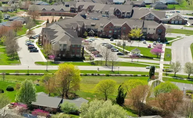
As the largest retirement community in Pennsylvania—and one of the largest standalone non-profit communities in the country—Cross Keys Village includes apartments, cottages, and Bridgewater homes. New residential units and a Day Services and Memory Support Resource Center are scheduled to open in 2025. Decades of expansions and utility upgrades had resulted in a complex and undocumented underground network, including both active and abandoned systems.
“…They were really kind of trying to figure out where this water line was on their campus,” explained GPRS Market Segment Leader for Facilities, Rhett Teller. “[The new facility director] was like, ‘the guy who just retired took a lot of institutional knowledge with him, and now I’m here holding the bag and the keys and I don’t really know where everything is.’ Listening to his problem and trying to craft a customized solution for him was kind of our single objective walking into the initial meeting.” Pomraning employed electromagnetic (EM) locating and ground penetrating radar (GPR) to trace the leaking utility. EM locators detect signals from metallic conductors. These signals can be induced by a transmitter or result from ambient electrical fields. Current flows from the transmitter along the conductor and returns via a grounding stake, completing the circuit.
GPR uses radio waves to identify subsurface anomalies. Signals reflect off materials of differing dielectric constants, revealing objects such as pipes, conduits, and storage tanks. These reflections are visualized as hyperbolic patterns, whose shape and intensity vary by material type and depth. GPRS Project Managers are trained to interpret these signatures and determine utility depth and alignment with high accuracy via Subsurface Investigation Methodology or SIM. All GRPS Project Managers are SIM-certified level 101 or higher, and it plays a large part in our ability to maintain 99.8% accuracy in utility locating. Learn more about SIM, here.
Pomraning accessed the copper water line inside a nearby structure, then traced it outward with the EM locator. When the line transitioned to plastic and EM signal was lost, he switched to GPR to continue tracking. The investigation revealed that a coaxial cable had been improperly routed through the water line, breaching the pipe and causing the leak.
“We figured out the position of the leak because it was where a cable TV installer crossed the line,” Pomraning confirmed.

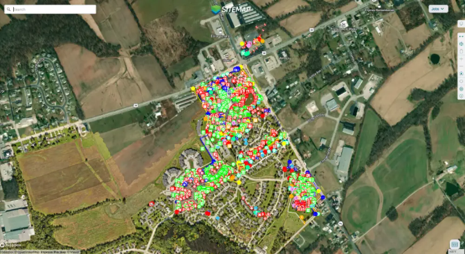
A full, interactive campus utility map, overlaid on a satellite image and stored in SiteMap® (patent pending), GPRS’ GIS-based delivery software that provides customers a permanent record of their underground utility infrastructure.
Beyond resolving the leak, Pomraning documented utility locations on-site and uploaded the findings to SiteMap®, GPRS’ secure, cloud-based infrastructure mapping platform. SiteMap® aggregates verified utility data from the field into a digital, geospatial interface accessible via desktop or mobile device. Designed for planning, construction, and operations workflows, SiteMap® ensures continuity of knowledge and improves risk management.
The platform allows facilities personnel to visualize assets in real time. With tiered access levels, SiteMap® can be configured for single-site managers or national portfolios. All GPRS clients receive complimentary SiteMap® access as part of their service package.
Upon reviewing the utility data in SiteMap®, the facility director recognized the platform’s potential and initiated a broader mapping effort across the campus. Teller, alongside GPRS Business Development Manager Isaiah Runkle and Area Manager Sam Hart, established a SiteMap® Pro agreement with Cross Keys Village. The arrangement includes ongoing subsurface utility mapping, emergency response, video pipe inspection (VPI), and leak detection support.
“We’ve been really using every service…” Hart said. “It’s been a really good relationship.”
“Really, [the facility director] was trying to solve his issue with the water line,” Teller added. “From that, we started talking about all the other things that we could help them solve, and creating an as-built was one of those.”
GPRS continues to provide actionable subsurface data to support facilities in maintaining safe, compliant, and efficient operations.
How can we help your municipality or campus visualize critical infrastructure?
