The Evolution of Electromagnetic Utility Scanning – From Faraday’s Discoveries to Today’s Industry Standard
Contemporary electromagnetic locating systems continue to evolve in response to dense utility grids and overlapping lines.
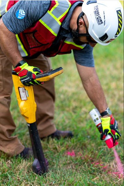
Modern EM Locators are based on principles first demonstrated in 1831.
Foundations in Electromagnetic Induction
The origins of electromagnetic utility scanning trace back to 1831, when British physicist Michael Faraday delivered a landmark presentation to the Royal Institute in London. He not only demonstrated the principles of electromagnetic induction but also speculated on its future as a method for measurement—an insight that would prove foundational to the development of modern utility location technologies.
Although Faraday’s discovery laid the groundwork, it wasn’t until 1910 that electromagnetic induction was formally adapted for detecting faults in underground cables and pipelines. These early systems were large, unwieldy, and operated by multiple technicians, but they marked a significant leap forward in locating hidden infrastructure and addressing the growing challenges of fault detection.
The subsequent decade saw rapid innovation in design and usability. Lighter, more accurate devices were introduced, and with them, a burgeoning demand for skilled technicians. As urbanization accelerated, both private industry and government agencies recognized the strategic value of electromagnetic locating for mapping and maintaining underground utilities.
Divergent Approaches: U.S. vs. European Utility Scanning
From 1920 to 1940, the growth of major cities drove further evolution in scanning technologies. Yet, approaches diverged due to differences in urban development patterns on either side of the Atlantic.
In the United States, cities expanded horizontally, resulting in utilities that spanned wide distances. Consequently, American manufacturers favored low-cost, high-frequency devices optimized for broad, shallow scanning ranges.
By contrast, Europe’s vertically layered cities were more dense, and necessitated tools capable of deep penetration beneath old streets and layered infrastructure. This required more complex equipment and highly trained operators. In fact, European utility scanning demanded a level of technical proficiency that far surpassed what was required in many parts of the U.S., due to the intricacy of subsurface environments.
Post-War Innovation in Subsurface Detection
The post–World War II era ushered in a new phase of commercial technology expansion. As cities expanded once again in the 1950s and 60s, so too did the need for advanced subsurface utility locating.
A pivotal moment came with Dr. Gerhard Fisher’s development of the Metallascope, the first high-performance utility locator. This landmark invention laid the foundation for the Fischer company’s modern M-Scope line of instruments still in use today.
Another milestone arrived in 1964, when Bell Laboratories – struggling to detect faults in its underground telephone cables – designed a novel two-sensor scanning tool. Known as the Depthometer, this device combined enhanced resolution with basic depth estimation. It quickly became the industry benchmark for electromagnetic subsurface location.
Advancements in Twin Antenna Systems
The introduction of dual-antenna technology represented a significant improvement in both resolution and precision. These systems could discriminate between multiple lines in close proximity while automatically estimating their depth, greatly enhancing diagnostic accuracy for subsurface conditions.
Equally transformative was the integration of compact electronic circuitry, which paved the way for smaller, more mobile devices. This innovation arrived at a critical time, as U.S. cities underwent extensive upgrades to power, water, and telecom infrastructure. Accurate, minimally invasive locating became essential to avoid costly utility strikes during excavation.
The Modern Era: Precision, Depth, and Versatility
Contemporary electromagnetic locating systems continue to evolve in response to dense utility grids and overlapping lines. Several key advancements have emerged, including:
- Simultaneous multi-frequency scanning for locating varied targets
- Integration of active and passive tracing modes
- Real-time current detection and defect testing along live lines
- Push-button depth estimation and digital readouts
- Multi-surface adaptability across concrete, asphalt, and submerged terrain
Today, electromagnetic induction remains one of two gold standards for non-destructive utility location. Its range of applications extends beyond traditional construction and utility work to archaeology, environmental monitoring, and civil infrastructure assessment.
GPRS is proud to be at the forefront of this field, equipping teams nationwide with advanced scanning capabilities. Our expert SIM-certified Project Managers serve complete an average of 120,000 projects annually, ensuring safe excavations and protecting America’s vital subsurface networks. In fact, GPRS proudly maintains a 99.8% accuracy rate for utility locating and concrete scanning.
It’s just another way we Intelligently Visualize The Build World for customers nationwide. What can we help you visualize?
Note: GPRS does not provide geophysical, geological, land surveying or engineering services. For those needs, consult a qualified professional